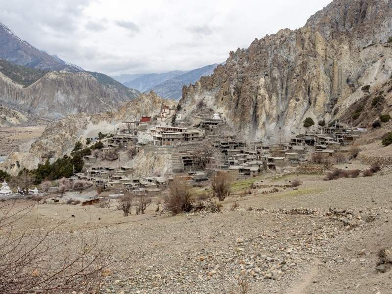
Annapurna Circuit Trek – 13 Days | Route, Price & Itinerary
TripAdvisor Reviews Recommended by 99.99% travelers
13 Days
Challenging
5,416 M
Trip Highlights
- Cross Thorong La Pass at 5,416 meters, one of the highest trekking passes in the world.
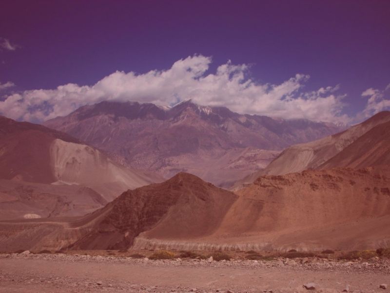
- Experience a dramatic shift in environment from subtropical forests to high-altitude desert within days of walking.
- Visit the sacred Muktinath Temple, where Hindu and Buddhist pilgrimage traditions harmoniously coexist.
- Trek through the world’s deepest gorge, Kali Gandaki, which measures at 5,571 meters between Nepal’s highest peaks.
- Spend acclimatization time in Manang Valley exploring Ice Lake, ancient monasteries, and traditional villages.
- Walk through local ethnic communities of Gurung, Magar, Thakali, and Manangi people
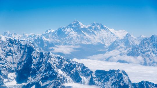
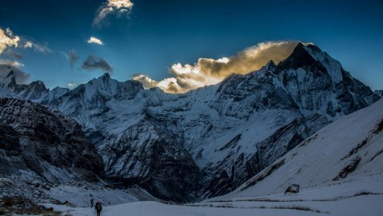
- Witness close-up views of Annapurna I, Dhaulagiri, Machapuchare, Gangapurna, and dozens of 6,000-8,000 meter peaks.
- Relax in natural hot springs at Tatopani after completing the challenging high pass crossing.
- Explore the beautiful lakeside city of Pokhara with stunning mountain reflections in Phewa Lake.
- Experience authentic teahouse trekking with comfortable lodges and home-cooked meals throughout the circuit.
Overview of Annapurna Circuit Trek – 13 Days | Route, Price & Itinerary
In just 13 days, the Annapurna Circuit Trek offers you a journey to circle the beautiful Annapurna Mountain range in Nepal’s Annapurna Conservation Area.
The trek passes through two completely different river valleys: the Marsyangdi and the Kali Gandaki.
This beautiful 13-day journey starts in the subtropical lowlands and, with each passing day, you will ascend through multiple climate zones.
In fact, from the very first day in the Annapurna region, you will walk through rhododendron forests, alpine meadows, and finally reach high-altitude desert terrain. But wait! That’s not it! This particular trek has also been voted as the best long-distance trek in the world.

Most trekkers complete this entire circuit in 12 to 22 days, so our 13-day itinerary is quite balanced.
But here’s what truly makes the Annapurna Circuit better than other Himalayan treks worldwide. Every single day in this journey brings completely new scenery, different cultural encounters, and fresh mountain perspectives.
As a matter of fact, till the time you reach the highest point, Thorong La Pass at 5,416 meters, you will have seen the Himalayas that mightn’t be visible in any other trek, with the elevation gain of just around 4000 meters. Additionally, unlike extreme mountaineering expeditions, it remains accessible to fit trekkers without technical skills.
Besides all that, since the whole Annapurna trekking region is well connected by a teahouse network, you don’t need camping equipment or heavy loads. This crazy network offers a unique opportunity to experience authentic Himalayan hospitality.
What Does the Annapurna Circuit Trek Route Look Like?
During the trek, we walk the route counterclockwise, which provides slower daily altitude gain and easier pass crossing. This direction also means the dramatic Kali Gandaki Gorge descent happens after the pass rather than before.
Besides that, our trek typically begins at Jagat at approximately 1,300 meters in elevation. Daily walking distances range from 5 to 15 kilometers, with trekking times averaging 4 to 8 hours. This ensures the natural acclimatization, helping even beginners complete the entire journey.
While you explore this classic region, you can get a close-up view of Annapurna I at 8,091 meters, the world’s tenth-highest mountain. But wait, that’s not it, you will also see Dhaulagiri at 8,167 meters, Manaslu at 8,163 meters, and countless other peaks.

However, the high Himalayas aren’t the only attraction on the route. Before reaching Thorang La pass, you can go through the Annapurna Conservation Area, Nepal’s largest protected area established in 1986. This conservation success story protects diverse ecosystems ranging from subtropical forests to high-altitude landscapes.
In fact, you can easily sight Himalayan animals like the Himalayan Tahr, the Blue Sheep, various pheasant species, and numerous bird varieties. The changing seasons bring different highlights, from spring rhododendron blooms to autumn’s crystal-clear mountain views.
See, we told you, this trek is one that you will remember for a lifetime. Now, without any further ado, let’s reveal our 13 Days Annapurna Circuit Trek Itinerary.
Detailed Itinerary
Day 1: Arrival and Welcome at Kathmandu (1,350m) jucihwdujncndi
Your Annapurna Circuit adventure begins the moment you land at Tribhuvan International Airport in Kathmandu.
We will receive you at the airport and transfer you directly to your hotel in Thamel.
After settling into your hotel, we arrange a comprehensive trek briefing with your experienced guide. During this meeting, the guide explains the entire 13-day itinerary, safety protocols, and cultural etiquette.
We then proceed to sort all necessary permits, including the ACAP and TIMS Card.
Before leaving, the guide conducts a thorough gear check to ensure you have appropriate clothing for all elevation zones.
If you’re missing any essential items, Thamel has excellent shops that sell and rent quality trekking equipment.
Kathmandu sits at an elevation of 1,350 meters, which causes minimal altitude effects for arriving international travelers.
Day 2: Drive Kathmandu to Jagat (1,300m)
Day 2 is going to be a long but heartwarming drive covering approximately 210 kilometers over 8 to 10 hours.
Your journey begins early, around 6:00 AM, to make the most of daylight hours.
We follow the famous Prithvi Highway westward, the main road that connects Kathmandu and Pokhara.
The route passes through Naubise, where the Tribhuvan Highway meets the Prithvi Highway.
From there, the road descends dramatically to Mugling at just 200 meters elevation beside the Trishuli River.
Continuing west, the highway reaches Dumre, where we turn north toward Besisahar.
Note: Besishahar sits at an elevation of 760 meters and serves as the administrative headquarters of Lamjung District.
From Besisahar, the road becomes rougher as we transfer to local jeeps for the journey to Jagat.
The jeep road follows the powerful Marsyangdi River upstream through increasingly spectacular gorge scenery.
Jagat sits at 1,300 meters and marks the first village in Manang District when approaching from the south.
This stone village features traditional architecture and serves as the official starting point for treks.
At the end of the day, you will be amazed by the truly unique topographies that Nepal has to offer.
Day 3: Drive to Lower Pisang and Trek to Upper Pisang (3,300m)
Day three combines jeep transportation with your first actual trekking to reach Upper Pisang village.
The morning jeep ride continues following the Marsyangdi River through increasingly dramatic mountain scenery.
Following the route, we first appear at Chamje at 1,410 meters, where you will find a spectacular suspension bridge and a massive 200-meter waterfall nearby.
Then, we reach Tal village at 1,700 meters, which sits in a wide river valley and was named after a glacial lake that once existed here.
Afterwards, we reach Dharapani at 1,860 meters, where ACAP permits are officially registered. This junction village also marks where the trails to the Manaslu Circuit and Nar-Phu Valley differ from the main route.
Then our journey leads to Bagarchhap at 2,160 meters, which showcases the first distinctly Tibetan architecture with white-washed stone houses.
The next destination we reach is Chame, at 2,710 meters, the district headquarters of Manang, with shops, bakeries, and banking facilities.
Note: Natural hot springs near Chame provide a relaxing stop, though most trekkers save time for later.
Then the road continues past Bhratang at 2,850 meters, situated below the dramatic 1,500-meter-high Paungda Danda cliff.
Before reaching Lower Pisang, we cross Dhukur Pokhari at 3,060 meters, which offers the first spectacular views of Pisang Peak and the Chulu peaks ahead.
Now, Lower Pisang finally appears at 3,200 meters with traditional Tibetan-style houses and terraced farmlands. From Lower Pisang, we begin the steep 30 to 45-minute climb to Upper Pisang at 3,300 meters.
This short trek gains only 100 meters but provides excellent acclimatization before tomorrow’s longer walk.
Upper Pisang offers breathtaking views of Annapurna II, III, IV, and Gangapurna.
Furthermore, the ancient Upper Pisang Monastery features intricate wood carvings, vibrant murals, and traditional Buddhist artwork.
Here you will find Ghyaru Gompa, another historic monastery locally known as Ogyan Thekchhok Ling Ki Gongba, which sits nearby.
The total jeep distance today covers approximately 66 kilometers from Jagat to Lower Pisang, taking around 4 to 6 hours, depending on road conditions.
Talking about the elevation gain from Jagat at 1,300 meters to Upper Pisang at 3,300 meters, it totals to around 2,000 meters. This significant altitude increase over a single day remains manageable because you’re riding rather than trekking.
Nevertheless, you might notice slight breathlessness during the short climb to Upper Pisang.
This signals your body beginning the acclimatization process for the higher elevations ahead.
Day 4: Trek From Upper Pisang to Manang (3,540m)
Today is one of the most spectacular trekking days on the entire Annapurna Circuit.
You have two route options: the scenic high route or the easier valley floor route.
We strongly recommend the high route for its incredible mountain views and cultural village encounters.
The high route begins with a descent from Upper Pisang to cross the Marsyangdi River on a footbridge.
You then pass by Mring Tso Lake, a small alpine lake that reflects the surrounding mountain peaks.
The trail then climbs steeply for three hours on switchback paths, gaining 430 meters to reach Ghyaru village. Ghyaru sits at 3,730 meters on a hillside with stunning teahouses offering a 180-degree view of the surrounding peaks.
From Ghyaru, the trail curves along the hillside for approximately five kilometers to Ngawal village. Ngawal, at 3,680 meters, features traditional architecture and an equally spectacular view of the Annapurna Range.
After Ngawal, the trail descends back to the valley floor, arriving at Braga village at 3,470 meters.
Here you will find Braga Monastery, one of the region’s most impressive gompas, with outstanding religious art.
From Braga, a short one-hour climb brings you to Manang, your destination for the next two nights.
The high route total distance measures approximately 15.5 kilometers, taking 6 to 7 hours to complete.
The highest elevation reached today is Ghyaru at 3,730 meters before descending slightly to Manang.
Manang village sits at 3,540 meters and serves as the acclimatization capital of the circuit. This, the largest settlement in the upper valley, features excellent lodges, bakeries, and the last reliable shops.
The Manangi people inhabit this region with a distinct Tibetan-influenced culture, language, and trading traditions.
Furthermore, the village showcases traditional flat-roofed stone houses with wooden balconies and prayer flags everywhere.
Multiple Buddhist monasteries dot the village and surrounding hillsides, including the impressive Gangapurna Monastery.
After the evening activities like exploring the village streets and visiting bakeries, we head in for the night.
Day 5: Acclimatization Day in Manang (3,540m)
Today represents the most important rest day of the entire Annapurna Circuit trek.
Manang sits at 3,540 meters, where oxygen levels drop to approximately 65 percent of sea level.
Your body requires 24 to 48 hours at this elevation to produce more red blood cells. These additional red blood cells carry oxygen more efficiently, preparing you for the higher altitudes ahead.
The golden rule of high-altitude trekking states: climb high during the day, sleep low at night.
Following this principle, we take acclimatization hikes to higher elevations before returning to Manang.
The most popular and beneficial hike climbs to Ice Lake, locally called Kicho Tal, at 4,620 meters.
This challenging trek gains 1,080 meters over 14 to 16 kilometers, taking 8 to 9 hours round trip.
A small teahouse at approximately 4,200 meters provides rest and refreshments during the climb.
This acclimatization hike proves excellent because you reach above 4,500 meters before sleeping at 3,540 meters.
Alternative shorter hikes include Gangapurna Lake at 3,540 meters, just 2 to 3 kilometers from Manang.
This beautiful glacial lake perfectly reflects Gangapurna’s massive 7,455-meter peak and its hanging glacier.
If you are really into culture, you can also visit Praken Gompa, which sits at 3,700 meters on a hillside overlooking Manang with large prayer wheels.
Another alternative route includes a hike to Khangsar village at 3,740 meters, which lies five kilometers northwest and serves as the gateway to Tilicho Lake. This remote settlement showcases a traditional mountain lifestyle and offers insights into subsistence farming at altitude.
From there on, you can visit Milarepa Cave at 3,950 meters, which holds spiritual significance associated with the famous Tibetan Buddhist yogi.
But regardless of any alternative route, you have to return back to Manang as our strategy for today is to sleep low.
After reaching Manang, it’s highly recommended to attend afternoon lectures about Altitude sickness conducted by the Himalayan Rescue Association.
After that, proceed to gear organization, rest, and socializing with other trekkers from around the world.
Today, you might face Mild altitude symptoms like headaches or difficulty sleeping, which are normal and usually resolve with rest. But we strongly advise you to tell our experienced guide as soon as the first symptom surfaces.
Day 6: Trek Manang to Yak Kharka (4,110m)
After two nights in Manang, you continue ascending gradually toward Thorong La Pass.
The trail follows the Thorong Khola stream valley with an increasingly arid landscape as you climb higher. Vegetation completely disappears at these elevations, replaced by grass, hardy shrubs, and bare rocks.
The path climbs steadily but never too steeply, allowing your body to continue adjusting to altitude.
Then, the Gunsang village appears at 3,900 meters after approximately two hours of walking from Manang.
This small settlement offers basic teahouses for rest stops and represents the last vegetation zone.
After Gunsang, the landscape transitions to true high-altitude alpine tundra with sparse vegetation.
The trail continues through rocky terrain with the Thorong Khola stream visible below.
Yak Kharka appears ahead at 4,110 meters after covering 10 to 11 kilometers total. The name translates literally as “yak pasture” because locals graze their yaks on these grasslands.
The settlement consists of only a few lodges built to withstand harsh high-altitude weather conditions.
Prayer flags flutter constantly in the wind while small chortens mark the village boundaries.
The community includes families from Gurung, Manangi, and Tibetan ethnic backgrounds. Yaks and horses graze on the surrounding slopes, adding an authentic mountain pastoral atmosphere.
The trek today takes 3 to 5 hours and covers a relatively short distance, with 570 meters of elevation gain.
Afternoons at Yak Kharka arrive early as lodges serve dinner around 6:00 PM.
Most trekkers go to bed by 7:00 or 8:00 PM to rest before tomorrow’s continued ascent.
Day 7: Trek Yak Kharka to Thorong Phedi (4,600m)
This day is going to be the final approach to the Thorong La Pass base camp at Thorong Phedi.
The trail continues upstream along Thorong Khola through increasingly barren, high-altitude desert terrain.
Ledar village appears after just 30 minutes at 4,200 meters with a few basic teahouses. This small settlement provides the last relatively flat section before the steeper climb begins.
After Ledar, the gradient increases noticeably as the trail climbs toward the pass approach. The landscape becomes completely barren with rocks, scree, and occasional hardy grass tufts.
Since there will be multiple small streams, you need to be really careful where you set foot while crossing.
Then, Thorong Phedi appears at 4,450 to 4,540 meters, which literally means “bottom of Thorong” in Nepali. This base camp settlement sits directly below the massive cliffs leading to Thorong La Pass.
The distance from Yak Kharka measures 6 to 7 kilometers, taking 2.5 to 5 hours.
The elevation gain totals 340 to 430 meters, depending on the exact starting and ending elevations.
At Thorong Phedi, oxygen levels drop to approximately 55 to 57 percent of sea level. This is one of the regions where we found that most of the trekkers get severe symptoms of altitude sickness.
While our guides do check in on you regularly, we also want you to contact your guide as soon as these symptoms appear.
But hey, if you are completely fine and have a little more energy, you can continue for another hour to Thorong High Camp at 4,880 meters. High Camp sits 400 meters above Phedi, significantly shortening tomorrow’s summit day climb.
The advantage means reaching the pass in 3 hours instead of 5 hours from Phedi.
However, High Camp offers much colder temperatures and more basic accommodation than Phedi.
The decision depends on your acclimatization status, energy levels, and guide recommendations.
Most trekkers eat dinner between 5:00 and 6:00 PM, then prepare gear for tomorrow’s early start.
Evening preparations include organizing warm layers, filling water bottles, and packing snacks.
Lights go out early around 7:00 or 8:00 PM as wake-up calls come at 3:00 or 4:00 AM.
Day 8: Cross Thorong La Pass (5,416m) and Trek to Muktinath (3,800m)
This will be the longest and most challenging day of the entire Annapurna Circuit trek.
Wake-up calls come at 3:00 or 4:00 AM for trekkers starting from Thorong Phedi.
The pre-dawn start allows crossing the pass before afternoon winds pick up around noon.
Temperatures hover between minus 10 and minus 20 degrees Celsius in the darkness before sunrise.
Headlamps illuminate the rocky trail, forming a line of lights that stretches upward toward the pass.
The first hour climbs the extremely steep zigzag trail from Phedi to High Camp. This section gains 400 meters over one kilometer on switchbacks through boulder fields.
From High Camp at 4,880 meters, the trail continues ascending toward the pass summit.
Every step becomes exhausting as oxygen levels drop to 47-48% of sea-level levels. At this altitude, instead of trying to summit quickly, you need to pace yourself and take frequent breaks.
A small tea shelter appears halfway up where trekkers pause briefly to warm their hands and faces.
The final approach to the pass involves more switchbacks over loose rocks and packed snow.
Then, finally, prayer flags appear ahead, marking the summit at 5,416 meters in elevation.
Hundreds of colorful Buddhist prayer flags flutter wildly in the wind, creating a vibrant display.
If you look around, you will find a stone cairn and signboard that confirms you’ve reached one of the world’s highest trekking passes.
From this region, the 360-degree views encompass the Annapurna range, Dhaulagiri, Thorong Peak, and countless surrounding summits.
The sense of accomplishment feels overwhelming after days of gradual ascent and acclimatization.
Most trekkers spend 15 to 30 minutes at the summit taking photos and absorbing the moment.
Staying longer increases altitude sickness risk, so the process of descent begins relatively quickly. The descent drops 1,616 meters over 10 kilometers to reach Muktinath at 3,800 meters.
This section is punishing on the knees and requires careful foot placement to avoid slips. Strong afternoon winds commonly develop, making the exposed descent even more challenging.
The barren high-altitude desert landscape gradually transitions as elevation decreases. Small streams appear, and vegetation slowly returns as you descend below 4,000 meters.
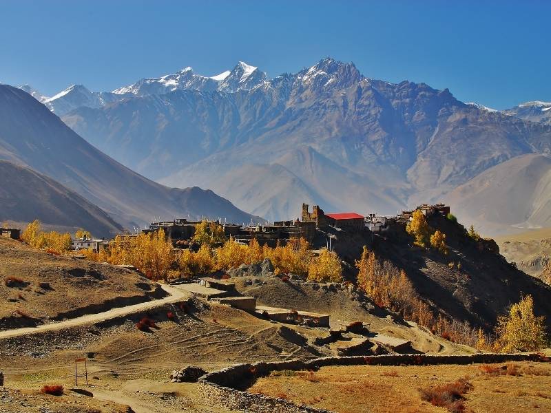
The trail passes through Chabarbu and Jharkot, small traditional villages with ancient monasteries. Jharkot village features distinctive Tibetan-style architecture and offers excellent Dhaulagiri range views.
The final approach to Muktinath follows the Jhong Khola stream valley. Then, Ranipauwa appears at 3,800 meters, where most lodges cluster around Muktinath Temple.
The total trek from Thorong Phedi covers 16 kilometers, taking 7 to 10 hours total.
Day 9: Visit Muktinath Temple, Drive to Tatopani (1,190m)
The morning begins with a visit to the sacred Muktinath Temple complex.
Muktinath ranks as one of Nepal’s most important pilgrimage sites for both Hindus and Buddhists.
The name derives from Sanskrit words meaning “Lord of Liberation” or “Place of Salvation.”
For Hindus, Muktinath represents one of the 108 Divya Desams, sacred Vishnu temples. Devotees believe that bathing under the sacred water spouts grants moksha, liberation from rebirth cycles.
The temple complex features 108 bull-head shaped water spouts arranged in a semicircle.
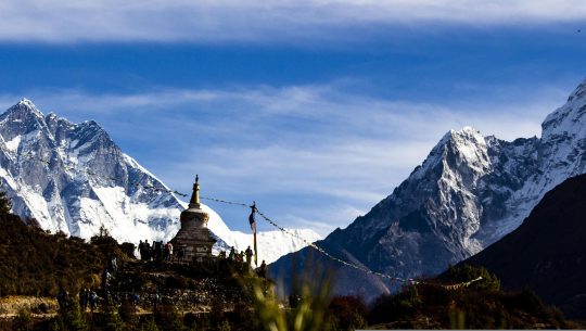
For Buddhists, Muktinath is associated with Guru Rinpoche, who introduced Buddhism to Tibet. Several Buddhist monasteries surround the area with prayer flags and chortens marking sacred spaces.
After temple visits, we begin the long drive to Tatopani, covering approximately 70 kilometers.
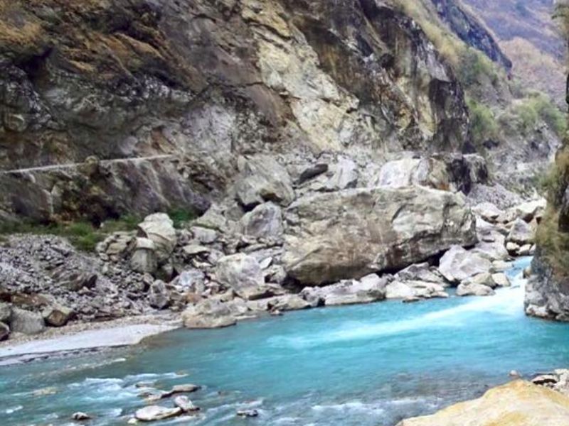
The route descends through the Kali Gandaki Valley, following the world’s deepest gorge.
The Kali Gandaki Gorge measures 5,571 meters in depth between the river and surrounding peaks.
If you look around Dhaulagiri at 8,167 meters, towers to the west, while Annapurna I at 8,091 meters rises east.
This creates the deepest gorge on Earth with two 8,000-meter peaks on either side.
Then, Kagbeni appears at 2,810 meters as a medieval walled village at the gateway to Upper Mustang. This restricted area requires special permits, but Kagbeni itself offers fascinating Tibetan architecture.
On the way, you might see the Red Monastery, Kag Chode Thupten Samphel Ling, which dates back 500 years.
Then you reach Jomsom at 2,720 meters, which serves as the Mustang district headquarters with an airport. Strong afternoon winds funnel through the gorge here, a daily phenomenon throughout the year.
Afterward, you will arrive at Marpha village at 2,670 meters, which represents the most beautiful settlement in the Kali Gandaki valley.
This perfectly clean village features white-washed houses, cobblestone streets, and underground drainage systems. Marpha remains famous for its apple orchards and produces excellent apple brandy and cider.
Then, we continue our journey to Tukuche at 2,590 meters, which prospered historically from the salt trade with Tibet.
After Tukuche, we descend to Larjung at 2,550 meters, which features a rare Bon monastery representing pre-Buddhist religion.
From then on, you descend to Kalopani at 2,530 meters and then to Ghasa at 2,010 meters, marking the transition from high-altitude desert back to subtropical forest zones.
After crossing Dana village at 1,400 meters, Tatopani finally appears at 1,190 meters, named for its natural hot springs.
The name translates literally as “hot water” in the Nepali language. Natural geothermal pools fed by underground hot springs provide perfect muscle relaxation.
After completing Thorong La Pass, soaking in these therapeutic waters feels absolutely heavenly.
The drive takes 3 to 4 hours in good conditions, but can extend to 7 hours.
The total descent from Muktinath at 3,800 meters to Tatopani at 1,190 meters totals 2,610 meters.
This massive elevation loss brings noticeably warmer temperatures and much thicker air.
Day 10: Drive Tatopani to Pokhara (822m)
This day will be another scenic drive covering approximately 100 kilometers over 4 to 6 hours.
The route initially follows rough dirt roads alongside the Kali Gandaki River to Beni.
Then we reach Beni, which sits at 870 meters, as the district headquarters where paved roads begin. This junction town marks the end of many Annapurna Circuit trekkers’ journeys.
Local buses and jeeps connect Beni with Pokhara throughout the day.
The road improves significantly after Beni, passing through Kushma and Baglung towns.
Then, Nayapul appears at 1,070 meters as the famous starting point for Poon Hill and ABC treks. The route then passes through Birethanti, a beautiful village with a suspension bridge.
Views of Machapuchare, also called Fishtail Mountain, become prominent as you approach Pokhara. This sacred 6,993-meter peak features a distinctive double summit resembling a fish tail.
Finally, Pokhara, the beautiful lakeside city, appears at an elevation of 822 meters.
The drive ends in the Lakeside area, where most tourist hotels and restaurants concentrate.
Check into your comfortable hotel with hot showers, WiFi, and all modern amenities. The dramatic contrast from high-altitude teahouses to lakeside comfort feels surreal and wonderful.
Day 11: Rest Day in Pokhara (822m)
Today provides well-deserved rest and exploration in beautiful Pokhara city.
Pokhara sits at just 822 meters, offering 4,594 meters lower elevation than Thorong La Pass. Your body recovers rapidly at this altitude with full oxygen saturation returning to normal.
Phewa Lake measures 5.23 square kilometers, making it Nepal’s second-largest lake, where you can rent paddle boats, rowboats, or kayaks to explore the peaceful waters at leisure.
Another destination might be Tal Barahi Temple, which sits on a small island in the middle, accessible only by boat.
Sarangkot Hill at 1,600 meters provides spectacular sunrise views of the Himalayan range. This beautiful site also serves as the launch site for world-class paragliding over the Pokhara valley.
For a few extra bucks, you can go on paragliding flights lasting 20 to 60 minutes, offering aerial views of Phewa Lake and mountain backdrops.
Then you can also visit Devi’s Falls, which features unique underground water drainage where Phewa Lake water disappears into tunnels.
The waterfall was named after a Swiss tourist named Davi who tragically fell in during 1961.
This rest day allows laundry, massage, quality meals, and mental processing of your trek accomplishments.
Day 12: Drive Pokhara to Kathmandu (1,350m)
The return journey to Kathmandu covers approximately 200 kilometers over 6 to 8 hours.
We follow the famous Prithvi Highway eastward, the same road taken on Day 2.
Early departure around 7:00 AM avoids heavy traffic near Kathmandu during the afternoon rush hours.
The highway follows the Seti Gandaki and Trishuli River valleys through dramatic gorge sections to Damauli.
Then we head to Mugling, which serves as a lunch stop with riverside restaurants famous for fresh trout.
After Mugling, the road follows the Trishuli River gorge to Naubise. Then, after an hour or so, we will finally enter Kathmandu Valley.
After 30 minutes, we arrive in Thamel, which feels like a full circle after the incredible 13-day mountain adventure.
Then, check into your hotel, and we will meet again to enjoy a special farewell dinner at a traditional Nepali restaurant with cultural dance. The evening allows reflection on the incredible journey from subtropical valleys to arctic passes.
Day 13: Final Departure from Kathmandu
Your final day begins with breakfast at the hotel, followed by the airport transfer.
We recommend arriving at Tribhuvan International Airport 3 to 4 hours before international flights.
The drive from Thamel to the airport is 5 to 6 kilometers and takes 20 to 60 minutes.
After reaching the airport, we will bid you farewell and wish you a safe flight.
11
7
Best Time to Visit Annapurna Circuit Trek
The Annapurna Circuit trek works best during two distinct seasons: Autumn and Spring.
Autumn Season: September to November (Peak Season)
Autumn represents the absolute best time for trekking the Annapurna Circuit. Late September through November offers the most stable weather and clearest mountain visibility.
The monsoon rains end in late September, leaving the atmosphere washed clean and crystal clear.
As a matter of fact, if we have to single out the best month to visit this trek, it’s going to be October.
Reasons why October is the best month for Annapurna Circuit Trekking:
- Daytime temperatures: 15 to 25 degrees Celsius at middle elevations
- Nighttime temperatures: 5 to minus 10 degrees Celsius depending on altitude
- Thorong La Pass temperatures: minus 10 to minus 20 degrees Celsius
- Clear blue skies dominate with minimal cloud cover
- Excellent visibility for photography and mountain views
On the other hand, November brings slightly colder temperatures but equally excellent visibility and stable weather.
The crowds thin out after mid-November as temperatures drop and winter approaches.
Late November can bring early winter snow to Thorong La Pass, requiring careful timing.
The second best season is Spring with warming temperatures and spectacular rhododendron blooms.
Spring weather conditions:
- Daytime temperatures: 18 to 25 degrees Celsius at middle elevations
- Nighttime temperatures: 5 to 10 degrees Celsius at lower elevations
- Thorong La Pass temperatures: minus 10 to minus 15 degrees Celsius
- Morning clarity with afternoon cloud buildup is common
- Occasional rain showers in the late afternoon
- Increasing temperatures as summer approaches
We strongly discourage trekking during the monsoon season from June through August. Heavy rainfall transforms trails into muddy, slippery, and dangerous paths.
Furthermore, cloud cover can offer really poor mountain views for days or weeks at a time. Landslides frequently block roads and trails, creating dangerous conditions.
On the other hand, winter brings extreme cold and potential snow accumulation at high elevations.
December through February creates harsh conditions, especially at Thorong La Pass, which is why we advise our trekkers not to trek during winter.
Who is This Trek For?
The Annapurna Circuit Trek 13 Days suits specific types of travelers and fitness levels. Understanding whether this trek matches your abilities ensures enjoyable and safe completion.
Ideal Trekker Profile
Fitness Level: Moderate to good physical fitness proves essential for successfully completing this trek.You should comfortably walk 5 to 8 hours daily carrying a light daypack.
Note: Previous multi-day hiking experience provides a significant advantage, though not absolutely required.
Age Range: The typical age range spans 18 to 60 years for most trekkers. Younger teens with good fitness and hiking experience can succeed with proper support. Trekkers above 60 years regularly complete the circuit if they maintain strong cardiovascular health.
Experience Level: First-time trekkers can complete the Annapurna Circuit with proper preparation and guidance. But we advise you to customize your itinerary if you are a first-time trekker.
Note: Our qualified team will help you customize your itinerary. You can just send us an enquiry.
How Difficult Is Annapurna Circuit Trek?
Understanding the Annapurna Circuit’s difficulty across multiple dimensions helps set realistic expectations.
This trek challenges you physically, tests altitude adaptation, and demands mental resilience.
Route Difficulty: Moderate
The Annapurna Circuit route difficulty is rated moderate.
Daily trekking distances range from 5 to 16 kilometers with variable elevation changes. Some days involve gentle valley walking, while others demand hours of steep climbing.
Well-established paths connect all villages with clear direction markers throughout. Lower sections feature stone-paved trails and occasional suspension bridges over rivers.
On the other hand, higher sections become rockier with loose scree and potentially snow-covered sections. The trail never requires technical climbing skills or mountaineering equipment.
However, narrow sections along cliff edges demand careful attention and sure footing.

Physical Difficulty: Challenging
The physical demands prove significant even for fit individuals.
Daily Trekking Duration: Most days require 4 to 8 hours of continuous walking with rest breaks.
However, the Day 8 crossing of Thorong La Pass extends to 7 to 10 hours total. This sustained daily effort over nearly two weeks taxes even strong hikers.
Elevation Gain and Loss: The cumulative elevation gain totals approximately 4,000 meters from start to highest point, which can be challenging to handle if you don’t pace yourself.
Cardiovascular Demand: Reduced oxygen at altitude increases heart rate even during slow walking. Your cardiovascular system works significantly harder than at sea level.
Proper acclimatization allows adaptation but doesn’t eliminate the increased effort required.
Muscle Fatigue: .The descent from Thorong La drops 1,616 meters in a single day. This massive descent is extremely hard on the knees and quadriceps.
Sleep Quality: Altitude can affect sleep quality, leading to frequent waking and restless nights.Poor sleep compounds physical fatigue, making recovery between days incomplete.
Chances of Altitude Sickness: Moderate to High
Altitude sickness poses the greatest risk on the Annapurna Circuit.
Altitude Profile:
The trek reaches 5,416 meters, where oxygen levels drop to 47% of sea-level levels. This elevation guarantees some altitude effects for virtually all trekkers. Most people experience at least mild symptoms above 3,500 meters.
Acute Mountain Sickness (AMS): It commonly occurs in Manang and higher elevations, affecting 50 to 75 percent of trekkers.
Emergency Response
Our guides carry pulse oximeters to monitor blood oxygen saturation levels. So, you need to contact them if severe cases occur.
If needed, they have contacts for Helicopter evacuation from Manang or other locations. In any severe cases, our guides are trained enough to handle this situation.
This is why comprehensive travel insurance that covers helicopter rescue is essential.
Travel Insurance Is Mandatory For Annapurna Circuit Trek
Comprehensive travel insurance represents a non-negotiable requirement for this trek.
Required Coverage:
- Emergency helicopter evacuation from altitudes up to 6,000 meters.
- Medical treatment and hospitalization in Nepal or evacuation to the home country.
- Trip cancellation and interruption coverage for unexpected changes.
- Coverage for lost or stolen gear, documents, and valuables.
Packing List For Annapurna Circuit Trek
This comprehensive packing list for the Annapurna Circuit Trek covers essentials for 13 days of mountain trekking.
Clothing System
Base Layers:
- 2 to 3 moisture-wicking short-sleeve shirts for daytime trekking.
2 thermal long-sleeve tops for cold mornings and high elevations.
- 2 pairs of thermal long underwear bottoms for sleeping and cold days.
- 3 to 4 pairs of moisture-wicking underwear.
Mid Layers:
- 1 fleece jacket or pullover for cool evenings and mornings.
- 1 lightweight insulated jacket for added warmth at altitude.
These layers trap body heat while allowing moisture escape.
Outer Layers:
- 1 down jacket rated to minus 15 to minus 20 degrees Celsius.
This proves essential for Thorong La Pass and high-elevation evenings.
- 1 waterproof and windproof jacket with hood.
- 1 pair waterproof rain pants for protection during unexpected weather.
Trekking Clothes:
- 2 to 3 pairs quick-dry trekking pants with convertible zip-off legs.
- 1 pair thermal trekking pants for cold high-altitude sections.
Avoid jeans as they dry slowly and provide no insulation when wet.
Accessories:
- 1 warm fleece or wool hat covering ears for cold conditions.
- 1 sun hat or baseball cap with brim for daytime sun protection.
- 1 lightweight neck gaiter or buff for wind and sun protection.
- 2 pairs liner gloves and 1 pair warm insulated gloves.
- Sunglasses with UV protection rated for high-altitude sun exposure.
Footwear:
- 1 pair sturdy waterproof trekking boots with ankle support.
These represent the single most important gear item.
- 1 pair camp shoes like sandals or light sneakers for teahouse evenings.
- 4 to 5 pairs trekking socks with moisture-wicking and cushioning.
Bring both thin liner socks and thick wool or synthetic hiking socks.
Technical Gear
- 40 to 50-liter daypack with padded hip belt and rain cover.
- Adjustable trekking poles
- Sleeping bag rated to -10 to -15 degrees Celsius.
- 2 one-liter water bottles or 1 hydration bladder system.
- Headlamp with fresh batteries and spare batteries.
Personal Items and Accessories
- High SPF 30 to 50 sunscreen and lip balm with UV protection.
- Travel-size toothbrush, toothpaste, biodegradable soap, and hand sanitizer.
- Quick-dry towel or pack towel
- Toilet paper and moist wipes
- Feminine hygiene products if applicable with disposal bags
Electronics:
- Smartphone with offline maps and emergency contact information.
- Camera with extra batteries and memory cards.
- Portable power bank with 10,000 to 20,000 mAh capacity.
- Universal adapter and charging cables for all devices.
- Headphones for entertainment during long drives.
Documents and Money:
- Passport with visa and copies stored separately.
- Travel insurance documents with emergency contact numbers.
- ACAP and TIMS permits kept accessible for checkpoints.
- Nepali rupees for daily expenses as ATMs become unavailable.
- Credit card for backup though rarely usable in mountains.
Pro Tip: Lay out all gear one week before departure for final checks. Wear or test everything to ensure proper fit and function. Replace batteries, check zippers, and verify nothing needs last-minute repairs.
Permits Required In Annapurna Circuit Trek
Two essential permits allow trekking in the Annapurna Conservation Area.
Annapurna Conservation Area Permit (ACAP):
- Cost: USD 30 per person (NPR 3,000)
- Children under 10 years trek free
- Validity: Single entry for trek duration
- Issued: Nepal Tourism Board office in Kathmandu, Pokhara, or Besisahar checkpoint
TIMS Card (Trekkers’ Information Management System):
- Cost: USD 10 per person
- Validity: Duration of registered trek
- Issued: Nepal Tourism Board office or Besisahar
We arrange both permits in Kathmandu before departure, saving you time and confusion.You just need to bring two passport photos and passport copies for permit applications.
Transportation During Annapurna Circuit Trek
Here are list of all the Transportation that we provide you during the trek,
Day 2 (Kathmandu to Jagat): Tourist bus from Kathmandu to Besisahar (6 to 7 hours). Local jeep from Besisahar to Jagat (1 to 2 hours on rough roads).
Day 3 (Jagat to Pisang): Jeep ride along Marsyangdi Valley (4 to 6 hours). Road conditions vary from paved to rough dirt tracks.
Day 9 (Muktinath to Tatopani): Jeep through Kali Gandaki Valley via Jomsom, Marpha, and Beni (3 to 7 hours).
Day 10 (Tatopani to Pokhara): Tourist bus or jeep (4 to 6 hours on paved roads).
Day 12 (Pokhara to Kathmandu): Tourist bus along Prithvi Highway (6 to 8 hours).
All transportation uses comfortable tourist vehicles with experienced mountain drivers.
Private vehicle options are available for groups preferring more flexibility and comfort.
Accommodation and Food During Annapurna Circuit Trek
During the trek, you will be getting the Teahouse accommodation, which are family-run lodges that provide twin-share rooms with basic beds and blankets. Rooms in these place feature simple wooden beds, thin mattresses, and shared bathroom facilities.
Pro Tip: Bring your own sleeping bag as the teahouse blankets vary in warmth and cleanliness.
Higher elevations offer more basic facilities with unheated bedrooms.
Food Options
If you really wanna go local, Dal bhat (rice, lentil soup, vegetables) remains the staple in this region with unlimited refills. However, teahouses also serve noodle soup, fried rice, momos (dumplings), pasta, and pancakes.
Talking about breakfast, Tibetan bread, porridge, eggs, and potatoes are available.
Food variety decreases at higher elevations due to limited resources.
Dietary Note: Vegetarian, vegan, and gluten-free options available upon advance notice. Inform us about dietary restrictions before the trek begins.
Expenses During Annapurna Circuit Trek
Internet Connectivity: WiFi available in most teahouses, charging USD 3 to 10 per day. But connections prove slow and unreliable, and is suitable only for messaging.
As you go to higher elevations, you have weaker signals and higher costs.
Mobile Network: Nepal Telecom (NTC) provides the best coverage throughout the circuit. Ncell works well at lower altitudes but becomes patchy above 3,500 meters.
Charging Devices: Teahouses charge USD 2 to 5 per device per charge. Costs increase at higher elevations where electricity proves limited. Bring portable power banks to reduce charging expenses.
Hot Showers: Hot shower costs range USD 3 to 7 depending on location. Solar-heated water is available at some lodges during sunny weather.
Bring enough Nepali rupees as ATMs disappear after Besisahar.
Popular Add-ons
Tilicho Lake Extension (2 to 4 extra days)
Poon Hill Trek (3 to 5 days)
Annapurna Base Camp (7 to 10 days)
Chitwan National Park (2 to 3 days)
Upper Mustang Trek (10 to 12 days)
Classic Annapurna Circuit Trek Is Waiting For You
The Annapurna Circuit Trek stands as one of the world’s most rewarding mountain adventures.
In just 13 days, you will experience dramatic transformations from subtropical forests to arctic passes.
So what are you waiting for? Book your Annapurna Circuit adventure and experience the Himalayas in their most accessible yet authentic form.
The trek delivers constant variety with new landscapes, cultures, and challenges every single day.
Crossing Thorong La Pass at 5,416 meters brings profound accomplishment without technical mountaineering skills.
The well-developed teahouse network makes this challenging trek accessible to fit trekkers worldwide.
Dates of Trip
1500 Save 201
March 1, 2026 - March 13, 2026
1500 Save 201
March 3, 2026 - March 15, 2026
1500 Save 201
March 5, 2026 - March 17, 2026
1500 Save 201
March 7, 2026 - March 19, 2026
1500 Save 201
March 10, 2026 - December 22, 2025
1500 Save 201
March 12, 2026 - March 24, 2026